Onomea Trail to Onomea Bay
Onomea Trail to Onomea Bay
Onomea Trail to Onomea Bay
Onomea Trail to Onomea Bay
Onomea Trail to Onomea Bay
Onomea Trail to Onomea Bay


Description
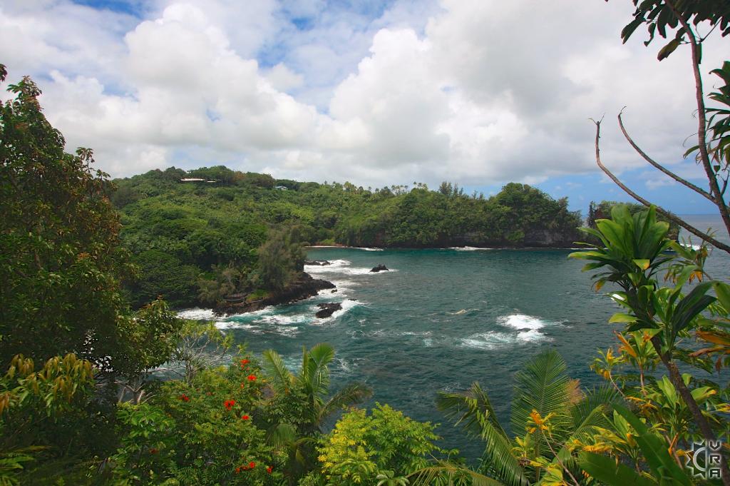
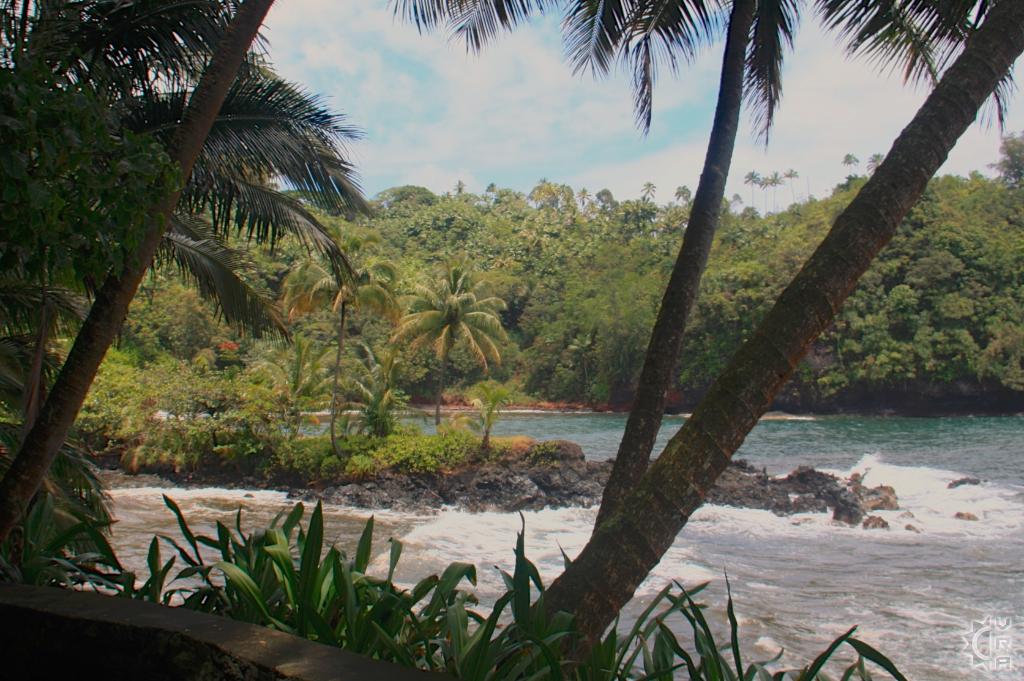
Just north of the central eastside town of Hilo along a 4-mile long scenic route known as "Old Mamalohoa Highway" you will find a State trail for public access to the beautiful Onomea Bay. This easy to follow trail crosses through a botanical garden and leads to the rocky shore and a freshwater stream, providing great access to jungle surroundings and the site of an ancient coastal fishing village.
Highlights: Scenic Onomea Bay is a picture postcard of old Hawaii. This public access shoreline trail leads to one of the most beautiful wild bays of the Hamakua coast.
Location: Hilo, Hawaii
Hazards!: Elevation change of 140 feet, but walk into the valley is down slope 500 feet or more before it levels, the remote bay is not a recommended swimming location due to dangerous currents and no lifeguard, but is great for its scenic value.
Length: 0.5 mile one-way.
Onomea Bay was originally a Hawaiian fishing village called Kahali'i, but by the early 1800's it had become a shipping port for the local sugar mill and donkey trails lead to the bay from the hills above where the mill was located. The area was largely abandoned and became over grown until it became privately owned in 1978, and opened to the public as a botanical garden in 1984.
Where to start:
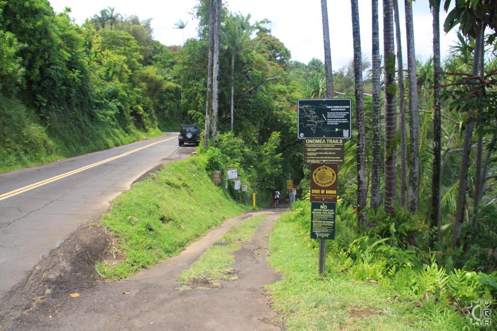
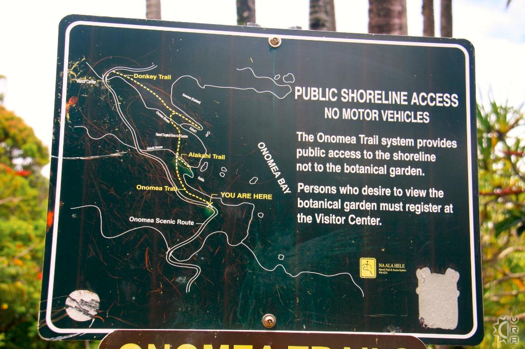
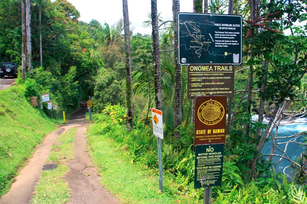
Onomea Trail follows the alignment of the old government road through the Hawaii Tropical Botanical Garden and splits at Alakahi Stream. One branch turns right to Kukilu Bay and the other continues directly across the garden to the east side of Onomea Stream. If the stream is not flooding then it may be forded at this point to connect with the Donkey Trail. This trail goes uphill and is steep and slippery and only for the avid hiker and leads to another portion of the Old Mamalohoa Hwy. The road has very little traffic so you could walk the road to the left for a little over a half mile to your car, making this a loop hike.
Local's Tip:
-pack some snacks and refreshment in your bag and allow 1.5 hours or more to be able to relax and enjoy the surroundings.
-Be prepared for some mosquitoes, they love the jungle just as much as the plants do. A light long sleeve shirt and pants make for best protection, the trail is largely shaded due to the forest canopy therefor sun exposure is not so much of an issue.
Directions:
- From Hilo: The trail is located about 7 miles north of Hilo. Take Route 19. Just after mile marker 7, turn right at large blue highway sign on the right saying "Scenic Route." Follow this Old Mamalohoa Hwy about 1.5 miles on the right look for the trailhead sign and look for parking along the shoulder of the road.
- From Kona: Follow Route 19 to the Hamakua Coast until you pass the 8 mile marker. Look for the blinking yellow light with sign on the right saying "Old Mamalahoa Hwy." Make the next left onto the Scenic Route. About 2 miles on the left (a mile past the tropical botanical garden) is a trailhead sign. Park along the roads shoulder.
Map