Nakoa Trail in Ahupua'a O Kahana State Park
Nakoa Trail in Ahupua'a O Kahana State Park

Description
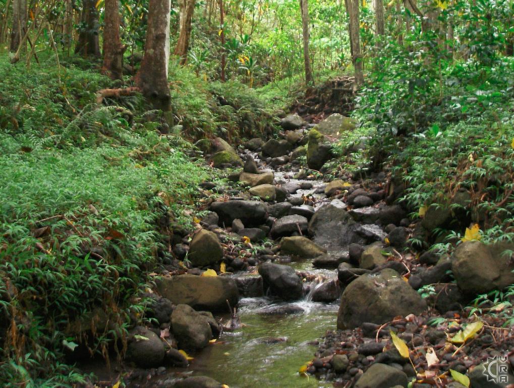
This windward coastal Valley is a step out of time. It is largely undeveloped and has the highest rainfall of any valley on Oahu, so it is very lush and full of jungle foliage and flowing streams. The drive to reach the Kahana Valley gets you away from the hustle of Oahu's development and into deep natural splendor.
At a Glance:
Highlights: Hike a valley largely undeveloped and wild, with streamside portions of trail that then rise to several scenic look outs, and even some world war II jungle warfare training grounds. A great day trip, with the hike taking 2 to 4 hours.
Location: Kahana, on the windward coast, north of Kailua
Activity Level: 3.5 mile loop: 2 to 3 hours to hike
Moderate to strenuous as the trail gains considerable elevation.
Equipment: Sturdy shoes, rain gear, water and food.
Warnings!: The trail crosses several streams which can flood during persistent or heavy rains. Avoid hiking here when flood warnings are posted from the National Weather Service. No cell service here.
Reservations: None needed
Cost: No fee
Ahupua'a 'O Kahana State Park has interpretive signage for teaching you the history of the Valley and its significance to the native culture. The word Ahupua'a refers to the watershed valley and the ancient Hawaiian way of stewarding the natural resources and lands from mountain to the sea. The entry to the Park has several cultural and education sites under development by the state. The hike begins further up valley, and crosses into the furthest reaches of this fertile landscape.
Where to Start:
Slowly drive up Kahana Valley Road past the initial neighborhood of houses and keep a look out for the trail head signage just before the second neighborhood of housing. There is a trailhead map, and easy to follow recommendations as to how to explore the valley safely. Facing up valley, the trail section to the left provides the shortest walk to stream access. It is recommended to begin with this section to assess the stream water level and flood potential before beginning the 3.5 mile loop.
A free trail map kiosk is located at the trailhead. There are also several points of interest detailed on the trail map, but the lush forest itself is also strewn with branching pig hunter trails toward the top of the trail system. Make sure to stay on the established main trail and carry a trail map. If you come across wild boar(pigs) they will often run away startled as they are the most hunted species in Hawaii.
State Park link for further details:
http://www.hawaiistateparks.org/hiking/oahu/nakoa.cfm
Address:
52-222 Kamehameha Highway
Kahana, HI 96717
Phone:808-237-7767
Directions:
From Honolulu, follow the Likelike Highway (Route 83) or H-3 over the Ko'olau Mountains and take the Kahekili Highway cut-off. Kahekili becomes the Kamehameha Highway (Route 830) heading north up the coast. Go through Ka'a'awa town, winding around into the next bay, the entry to Kahana State Park is in the coconut grove near the center of Kahana Bay where the road stretches the furthest inland along the bay.
Map