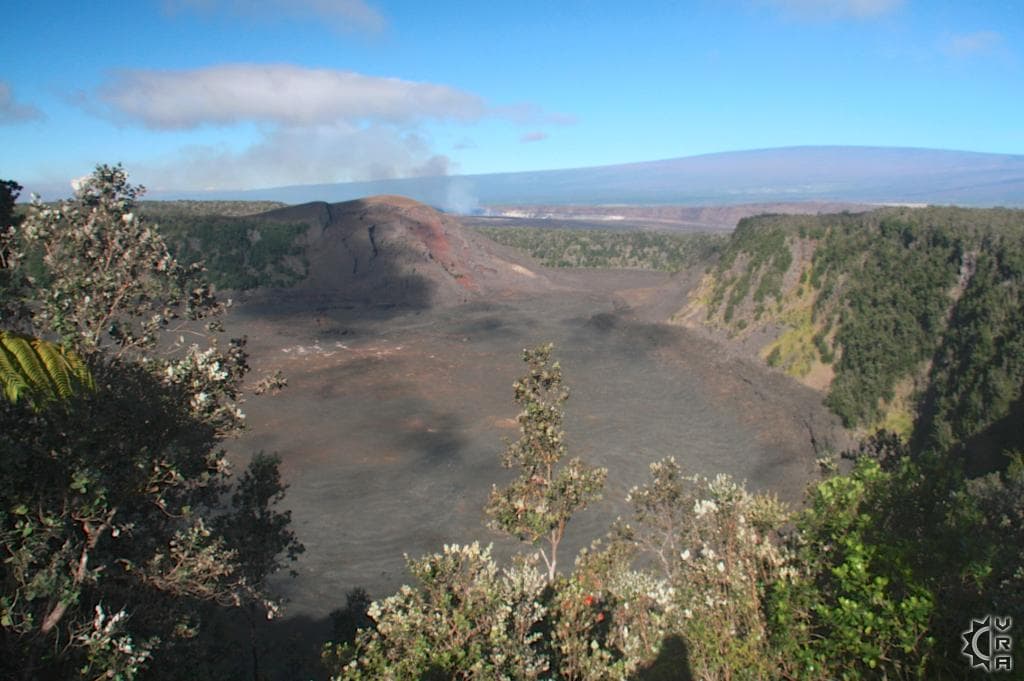

Kilauea Iki Trail at Hawaii Volcanoes National Park
Volcano, Big Island
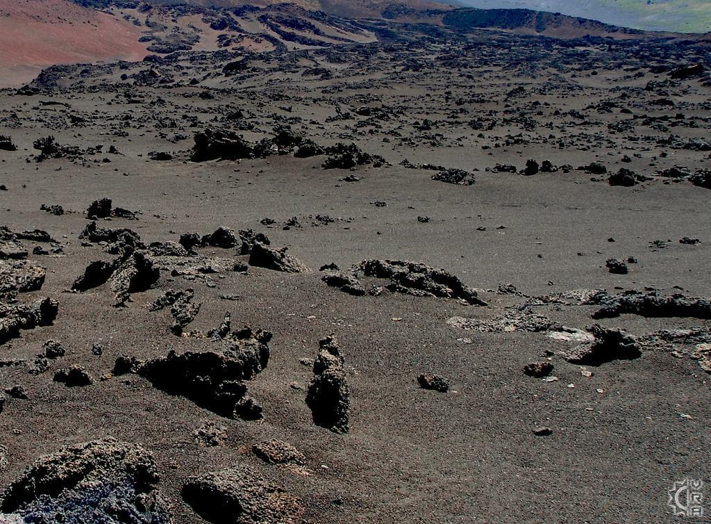
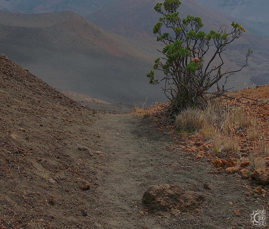
<p>This hike is truly epic Hawaiian experience. Maintained by the National Park, it exposes the lava rock origins of the Islands by giving you access to the Kilauea Iki crater floor. The added bonus of National Park hiking is the added interpretation, maintenance, and safety provided with Rangers on staff to help visitors enjoy the area safely. The added bonus of this hike is the adjacent "Thurston Lava Tube" where you can walk into the inside of a once flowing lava river now left hollow and lit for ease of exploration.<br><br><b>At a Glance:</b><br>Highlights: Imagine hiking on the moon, the stark volcanic landscape that surrounds this trail is "other worldly" and is accessed by hiking through a portion of pioneering native Ohia forest. <br>Location: Volcano, Hawaii<br>Activity Level: Moderate to strenuous with a 400 change of elevation.<br>Equipment: Sturdy shoes, rain gear, water and food.<br>Warnings!: Stay on the trails, and follow guidance given on site by park staff. When hiking through lava rock regions long pants and closed toed shoes give you the best protection from being cut by jagged stones.<br>Reservations: None <br>Cost: $10 fee per vehicle entry. <br><br>Hawaii Volcano National Park has interpretive signage for teaching you the geological story of this tumultuous and still volcanically active area. The eastern regions of the park remain active and surface flows are sometimes visible. A stop at the Park Headquarters is a must, giving you the best options for your visit. <br><br>There are many options for hiking within the Park. The Kilauea Iki trail is a good place to start as it provides access to hiking in a crater and is adjacent to a shorter trailhead that can give you the opportunity to explore inside a lava tube. The trailhead parking is 3 miles past the Park Headquarters and is well signed. The "Thurston Lava Tube Trail" is a popular destination within the park, but don't let the crowds repel you. The short 0.3 mile loop only takes about 30 minutes to enjoy round trip and makes a good warm up or follow up to hiking away from the crowds on the Kilauea Iki Trail. <br><br><b>Where to Start:</b><br>Across the roadway from Thurston Lava Tube area you will find the signage for the beginning of the 2.4 mile"Kilauea Iki" Trail. The trail winds through pioneering native Ohia trees and fern forest then down into a crater across lava rock from flows created by a 1959 eruption cycle. The vegetation becomes sparse as you descend 400 feet below the crater rim, and you begin to see the violent eruptive history petrified into the stones around you. There are many different textures to the rock, depending on the cooling time and elasticity of the molten lava. The smooth and twisted "Pahoehoe" lava cooled as it flowed like a river, jagged "a'a" was cooled as it fell to earth from violent explosions of lava at high pressure through cracks in the surface rock. At one point in the 1595 eruption, lava fountained nearly 1900 feet in the air…